-
 +2 +1
+2 +1MAPPS Privacy Guidelines Endorsement
In a unanimous move, NSGIC’s board of directors endorsed a set of privacy guidelines advising members to safeguard personal data — like real-time location, health and employment information — they gather, saying it’s protected by law. The guidelines were originally developed by the Management Association for Private Photogrammetric Surveyors, an industry group of geospatial data providers, and are meant to serve as a framework for self-regulation on the collection of geospatial data.
-
 +19 +1
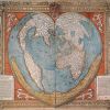
The History of Cartography, the “Most Ambitious Overview of Map Making Ever,” Now Free Online
Worth a quick mention: The University of Chicago Press has made available online -- at no cost -- the first three volumes of The History of Cartography. Or what Edward Rothstein, of The New York Times, called 'the most ambitious overview of map making ever undertaken.'
-
 +16 +1
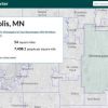
How to Get Census Data for Maps in 5 Steps
One of the largest and best free sources of data in the US is the Census Bureau’s American Fact Finder.
-
 +2 +1
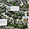
+2 +1Inside the Zestimate: Data Science at Zillow
If you're like most homeowners, you probably sneak a peek at your 'Zestimate' from time to time to see how your home's value might have changed. Here's a glimpse at the data science behind the curtain.
-
 +23 +1
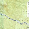
Topographic Maps and Route Visualization
Some people can read a topographic map and visualize what the landscape should look like based on the shape of the contours lines shown. It's a real skill to do it well, and while I'm pretty good at it, I can miss details unless I really concentrate.
-
 +12 +1
Geocoding: Comparing New & Old Methods
Do new tools available for geocoding addresses improve enough on what we already have?
-
 +14 +1
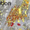
This Map Shows The Frightening Overlap Between Pollution and Poverty
The Environmental Protection Agency has a new tool called EJSCREEN, which lets you overlay the agency’s environmental data on a geographic map, along with layers of information showing poverty. The result is as depressing as you’d probably expect.
-
 +3 +1
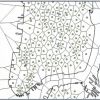
+3 +1Citi Bike Analysis and Automated Workflows with QGIS
Citi Bike, the bike share system in New York City, provides some interesting data that can be analyzed in many different ways using QGIS.
-
 +2 +1
+2 +1How to Geocode Addresses Using QGIS
Learn how to use QGIS to geocode (or map out) addresses.
-
 +2 +1
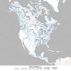
+2 +1River Width GIS Data Created from 1,756 Landsat Images
Researchers used 1,756 Landsat images to develop a GIS database of river widths for the entire North American continent.
Submit a link
Start a discussion


