


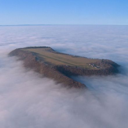

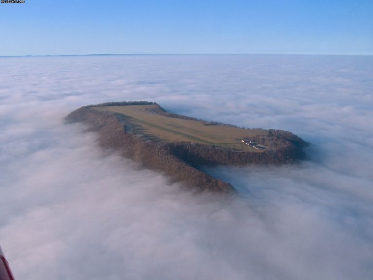
Clear to land
Seen here is the small runway/airport known as the Farrenberg aerodrome (FAR1). It sits atop a hill of the same name in the Baden-Württemberg region of Germany. You can see the tiny airport and runway on Google Maps by entering the following coordinates: 48°23’8.49″N 009°04’37.76″E. Due to Farrenberg’s elevation, it is often above the cloud ceiling and makes for dramatic pictures like these when viewed from above.


Join the Discussion